Trail Info:
Total Distance: 9.8 miles
Time: about 5 hours
Elevation Gain: 1,247 ft
Trails: Hancock Notch Trail, Cedar Brook Trail, Hancock Loop Trail
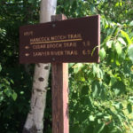
Parking: Hancock Overlook Parking Area just around the first hairpin turn on the Kancamangus Highway
Ratings:


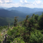
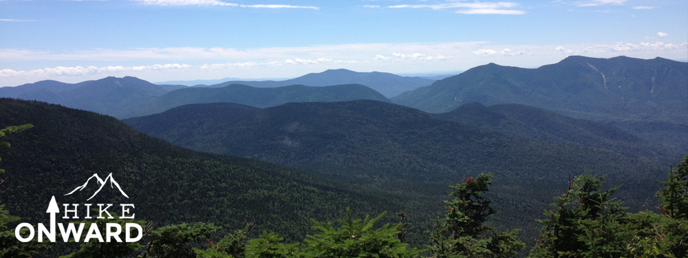
The trail was pretty flat until you reached the last half mile, then there was a steady incline. The overall hike is well maintained and easy to navigate. At the top, both peaks had a very nice view from a couple outlook points. There is tree cover surrounding each peak but the outlook points allow for spectacular views on a clear day.
Gear and Tips:
We did the hike within a day so we packed a light day pack for the hike. It was a very hot day so we had to pack plenty of water. The trail has areas where you are able to tent out for backpackers.
Summary:
 North and South Hancock are located in the Pemigewasset wilderness area of the White Mountains between Franconia Notch and Crawford Notch. Parking for this hike is located just around the first hairpin turn on NH Route 112/Kancamangus Highway at the Hancock Overlook Parking Area. To start the hike, we crossed the Kancamangus Highway and then trekked about 2 miles on relatively flat land.
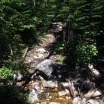
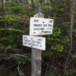
We were on the Hancock Notch Trail and were able to reach the intersections of the Hancock Notch Trail and the Cedar Brook Trail within 45 minutes by hiking a steady pace. We then took a left and started up the Cedar Brook Trail. The Cedar Brook Trail was an interesting trail as there were parts that felt like you were walking on a sponge. We had to cross the North Fork River twice while hiking along the Cedar Brook Trail. We then came upon another intersection where a sign guided us towards the Hancock Peaks. We then continues up the trail passing a few tenting areas where people were camping out. The trail started to gain a little in elevation but nothing too hard. We hiked for about a mile until we came upon the intersection for the Hancock Loop Trail. You could choose which peak you wanted to visit first (0.5 miles to South Hancock, 0.7 miles to North Hancock).
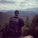
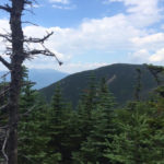
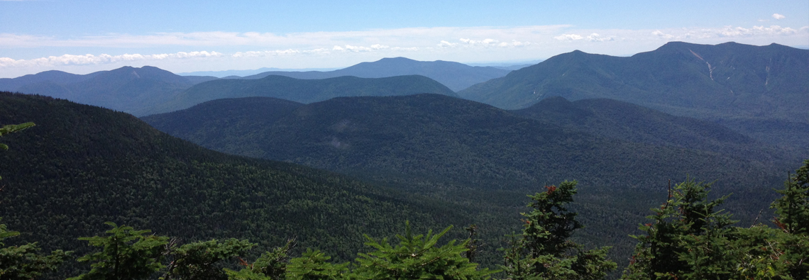
We decided to hike up to South Hancock first and started hiking up the trail. The trail rapidly started to increase in elevation. At some points it felt like we were rock climbing up the trail. The last half mile alone probably took us about 30-40 minutes to complete. We reached the summit of South Hancock where it was surrounded by trees. Luckily there is an amazing overlook area that overlooked the entire Kancamangus area along with views of Mount Garfield, Carrigan, and the Bond Cliffs. It sure was an amazing sight to see.
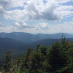
After relaxing for about an hour we continued the 1.4 mile hike over to North Hancock. It took us about 25 minutes to hike over to North Hancock. The trail went up and down for the most part, nothing too strenuous. We reached North Hancock where it was surrounded by trees. Again, luckily enough there was a sign pointing us to an outlook point. The view from North Hancock was also incredible overlooking South Hancock, the Tripyrimid’s and the Osceola’s. After taking a short break we started to hike down the Hancock Loop Trail.
The top of the North Side of the trail was covered in loose rocks so we had to take our time navigating down the trail to avoid injury. Eventually the loose rocks cleared up and it was a steady decline down the trail (Probably about the same amount as hiking up to South Hancock). Eventually the trail met back up at the intersection of the two trails where we then began retracing our steps down the Cedar Brook Trail and the Hancock Notch Trail. We completed the hike in about 5 hours.
Photos: